File:Raster Calculator for land lot suitability NXJ.JPG
Jump to navigation
Jump to search
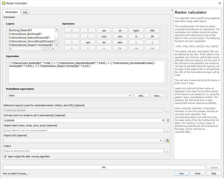
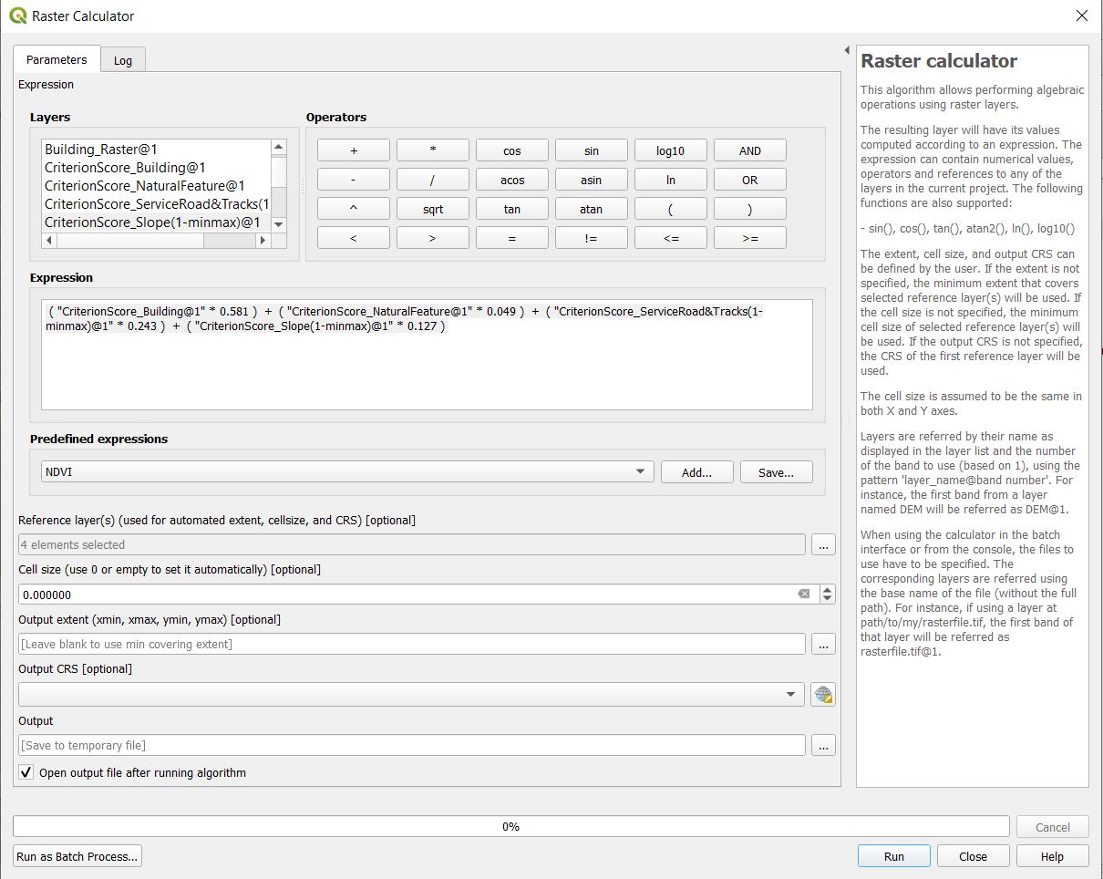
Size of this preview: 753 × 600 pixels. Other resolutions: 301 × 240 pixels | 1,210 × 964 pixels.
Original file (1,210 × 964 pixels, file size: 185 KB, MIME type: image/jpeg)
File history
Click on a date/time to view the file as it appeared at that time.
| Date/Time | Thumbnail | Dimensions | User | Comment | |
|---|---|---|---|---|---|
| current | 21:37, 10 November 2019 | | 1,210 × 964 (185 KB) | Xunjie.ng.2018 (talk | contribs) |
- You cannot overwrite this file.
File usage
The following page links to this file: