File:Proximity Map-min.png
Jump to navigation
Jump to search
Size of this preview: 800 × 566 pixels. Other resolutions: 320 × 226 pixels | 3,507 × 2,480 pixels.
Original file (3,507 × 2,480 pixels, file size: 1.25 MB, MIME type: image/png)
Summary
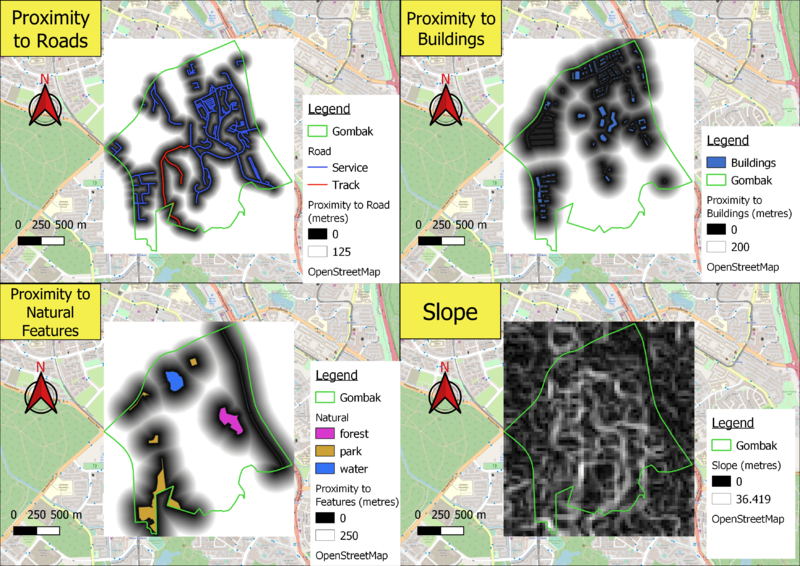
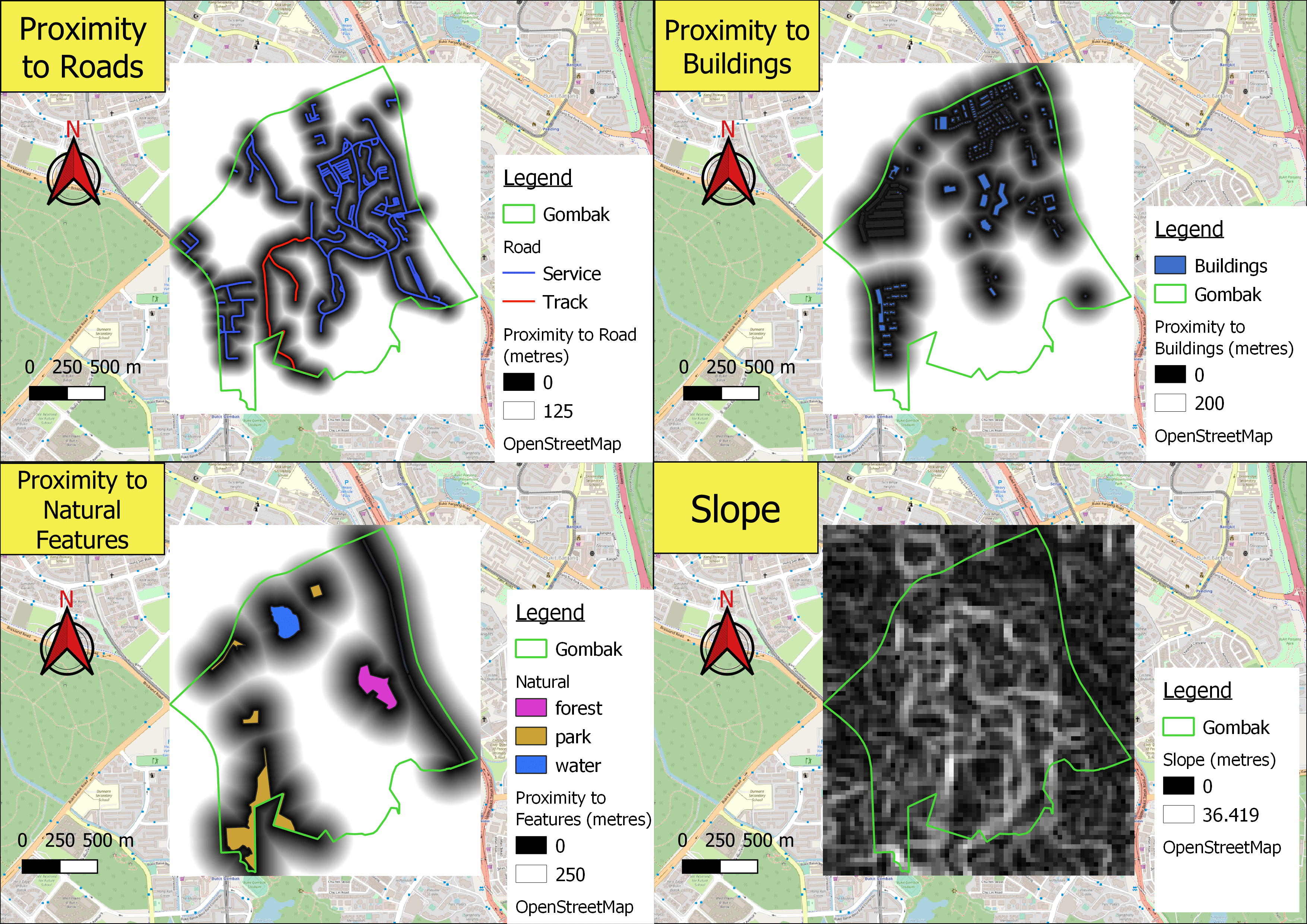
Proximity of features
File history
Click on a date/time to view the file as it appeared at that time.
| Date/Time | Thumbnail | Dimensions | User | Comment | |
|---|---|---|---|---|---|
| current | 12:46, 8 November 2019 | | 3,507 × 2,480 (1.25 MB) | Huiqin.tan.2018 (talk | contribs) | Proximity of features |
- You cannot overwrite this file.
File usage
There are no pages that use this file.