File:Proportional of Aged Population to Total Residents in 2010.png
Jump to navigation
Jump to search

Size of this preview: 800 × 458 pixels. Other resolutions: 320 × 183 pixels | 1,437 × 823 pixels.
Original file (1,437 × 823 pixels, file size: 805 KB, MIME type: image/png)
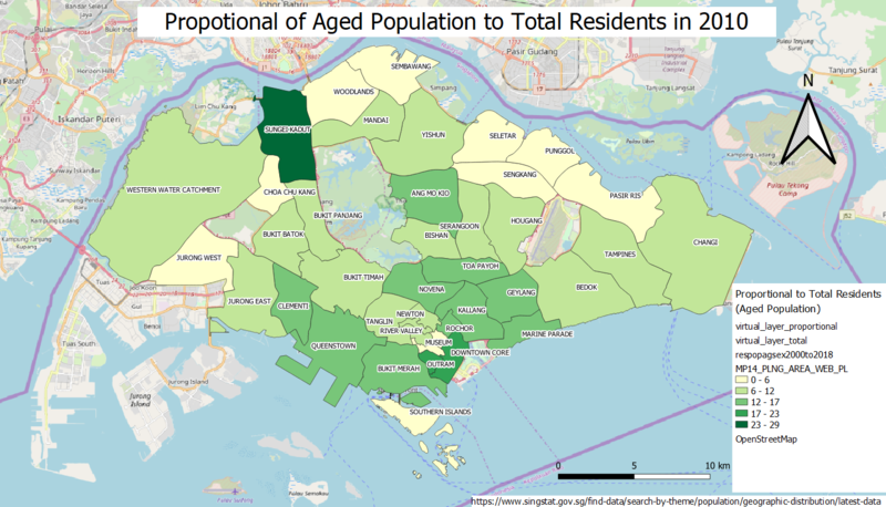
This is a choropleth map, showing the proportional of aged population of Singapore to Total Residents in 2010.
File history
Click on a date/time to view the file as it appeared at that time.
| Date/Time | Thumbnail | Dimensions | User | Comment | |
|---|---|---|---|---|---|
| current | 19:03, 15 September 2019 | | 1,437 × 823 (805 KB) | Kskning.2018 (talk | contribs) |
- You cannot overwrite this file.
File usage
The following page links to this file: