File:Part Two Proximity Raster w Roads, Buildings, Natural Areas and Slope Raster layer.png
Jump to navigation
Jump to search

Size of this preview: 800 × 566 pixels. Other resolutions: 320 × 226 pixels | 3,507 × 2,480 pixels.
Original file (3,507 × 2,480 pixels, file size: 1.12 MB, MIME type: image/png)
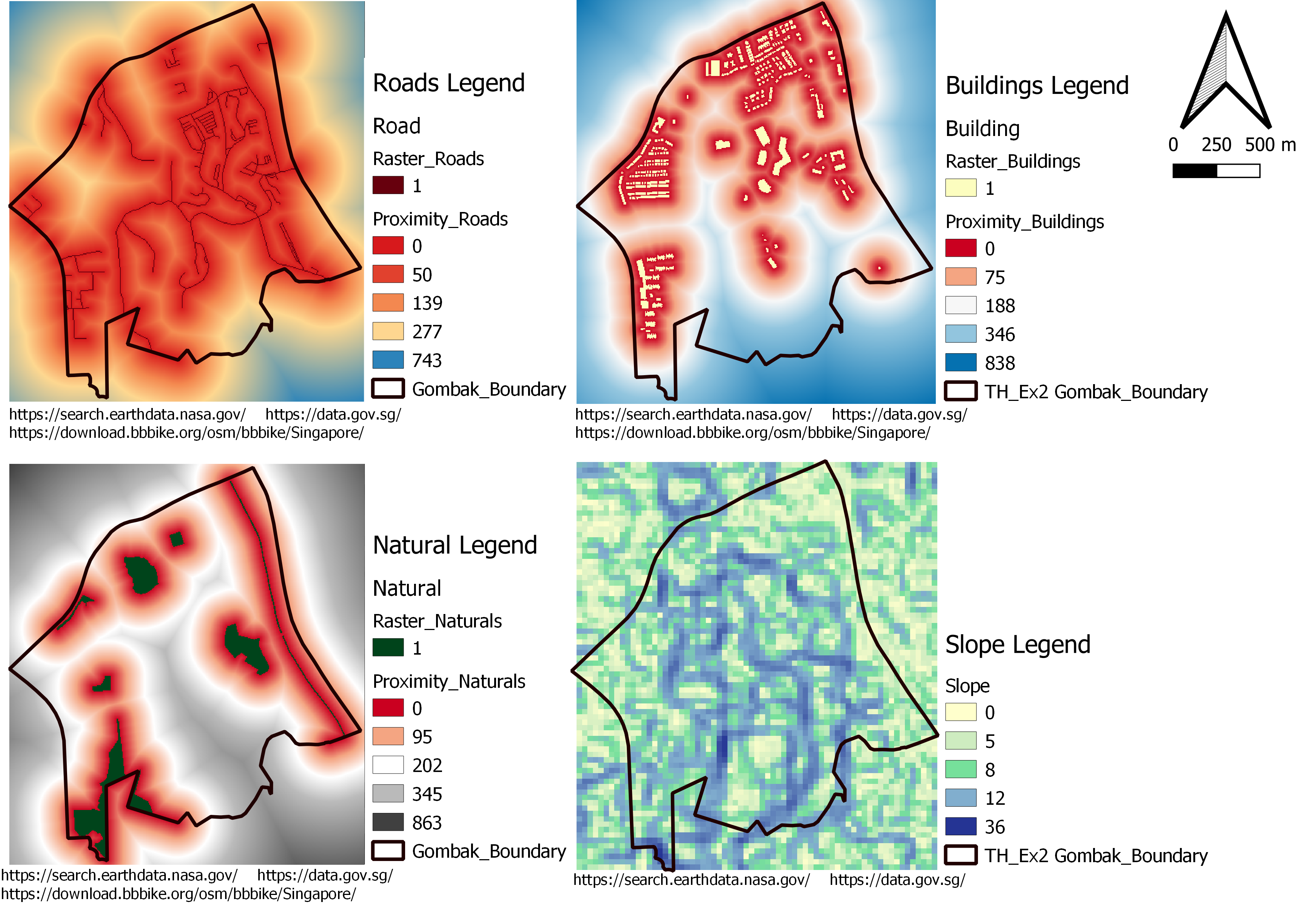
This is for part 2
File history
Click on a date/time to view the file as it appeared at that time.
| Date/Time | Thumbnail | Dimensions | User | Comment | |
|---|---|---|---|---|---|
| current | 19:38, 8 November 2019 | | 3,507 × 2,480 (1.12 MB) | Yuqi.gui.2016 (talk | contribs) |
- You cannot overwrite this file.
File usage
The following page links to this file: