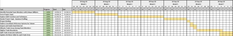
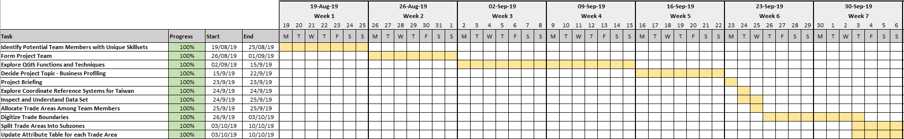
File:P1GanttChart1.png
Jump to navigation
Jump to search
Size of this preview: 800 × 124 pixels. Other resolutions: 320 × 50 pixels | 1,848 × 286 pixels.
Original file (1,848 × 286 pixels, file size: 41 KB, MIME type: image/png)
p1ganttchat1
File history
Click on a date/time to view the file as it appeared at that time.
| Date/Time | Thumbnail | Dimensions | User | Comment | |
|---|---|---|---|---|---|
| current | 22:09, 14 October 2019 | 1,848 × 286 (41 KB) | Brendan.ong.2018 (talk | contribs) |
- You cannot overwrite this file.
File usage
There are no pages that use this file.