File:Map5d KrystalOng.JPG
Jump to navigation
Jump to search
Size of this preview: 767 × 599 pixels. Other resolutions: 307 × 240 pixels | 938 × 733 pixels.
Original file (938 × 733 pixels, file size: 92 KB, MIME type: image/jpeg)
File history
Click on a date/time to view the file as it appeared at that time.
| Date/Time | Thumbnail | Dimensions | User | Comment | |
|---|---|---|---|---|---|
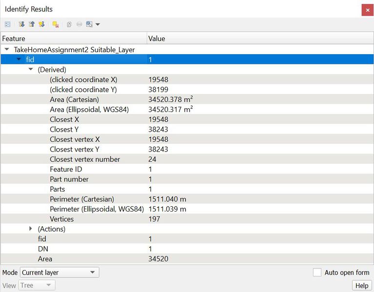
| current | 20:55, 10 November 2019 | | 938 × 733 (92 KB) | Krystal.ong.2018 (talk | contribs) | |
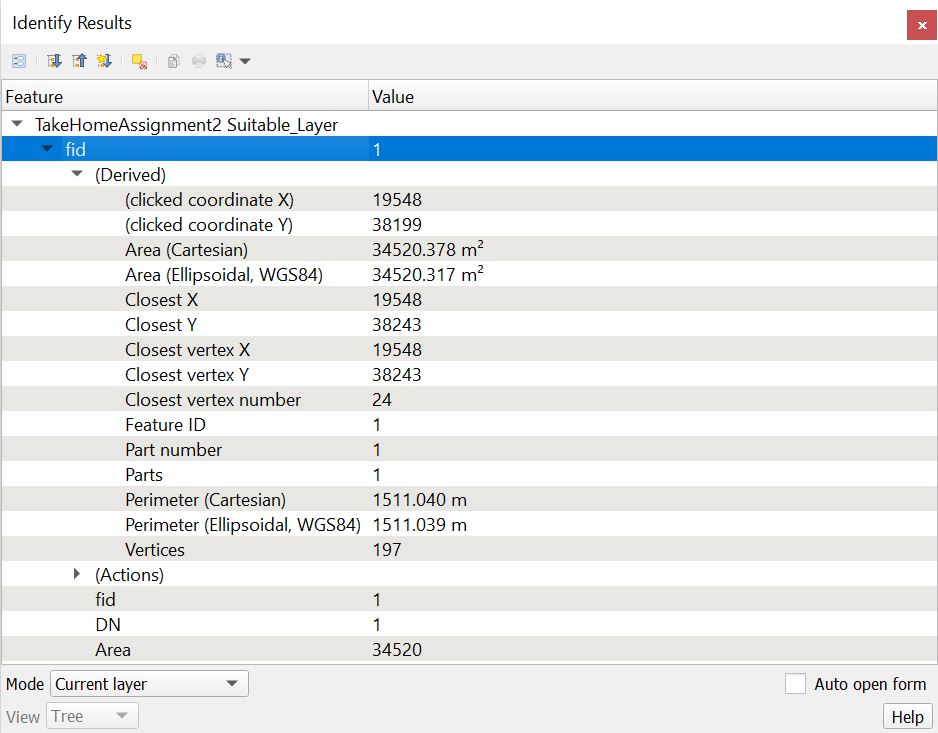
| 20:50, 10 November 2019 |  | 892 × 696 (83 KB) | Krystal.ong.2018 (talk | contribs) |
- You cannot overwrite this file.
File usage
The following page links to this file: