File:Layout for point 2.jpg
Jump to navigation
Jump to search

Size of this preview: 750 × 600 pixels. Other resolutions: 300 × 240 pixels | 2,000 × 1,600 pixels.
Original file (2,000 × 1,600 pixels, file size: 226 KB, MIME type: image/jpeg)
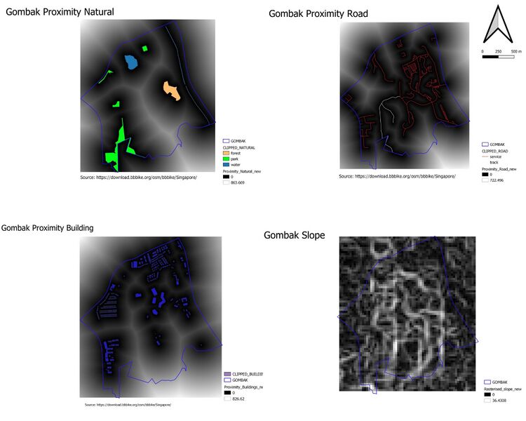
Four proximity views
File history
Click on a date/time to view the file as it appeared at that time.
| Date/Time | Thumbnail | Dimensions | User | Comment | |
|---|---|---|---|---|---|
| current | 21:47, 9 November 2019 | | 2,000 × 1,600 (226 KB) | Amelia.neo.2018 (talk | contribs) |
- You cannot overwrite this file.
File usage
The following page links to this file: