File:Gombak Study Area (Proximity).png
Jump to navigation
Jump to search

Size of this preview: 800 × 560 pixels. Other resolutions: 320 × 224 pixels | 2,376 × 1,664 pixels.
Original file (2,376 × 1,664 pixels, file size: 824 KB, MIME type: image/png)
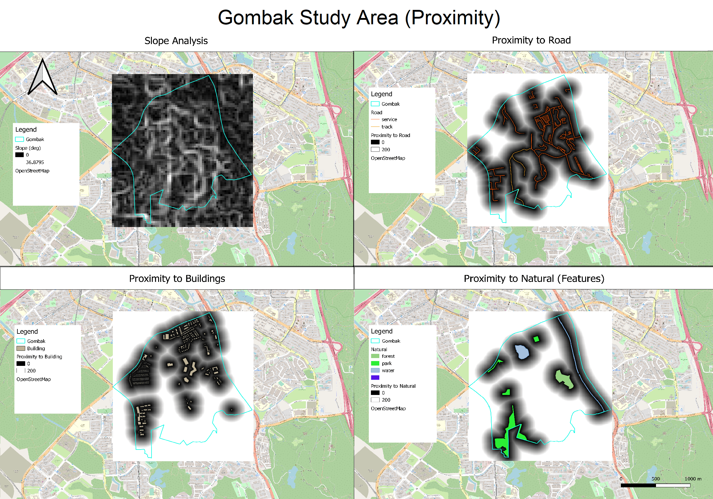
Map views of Proximity layers to features in Gombak
File history
Click on a date/time to view the file as it appeared at that time.
| Date/Time | Thumbnail | Dimensions | User | Comment | |
|---|---|---|---|---|---|
| current | 17:35, 6 November 2019 | | 2,376 × 1,664 (824 KB) | Bcheng.2018 (talk | contribs) |
- You cannot overwrite this file.
File usage
The following page links to this file:
.png&oldid=6900)
.png)
.png&action=edit&redlink=1)
.png&action=edit)
.png&action=history)
.png)
.png)
.png&printable=yes)
.png&oldid=6900)
.png&action=info)