File:Gombak Planning Subzone with Roads, Buildings, Natural Features and Elevation.jpg
Jump to navigation
Jump to search

Size of this preview: 800 × 588 pixels. Other resolutions: 320 × 235 pixels | 2,835 × 2,082 pixels.
Original file (2,835 × 2,082 pixels, file size: 751 KB, MIME type: image/jpeg)
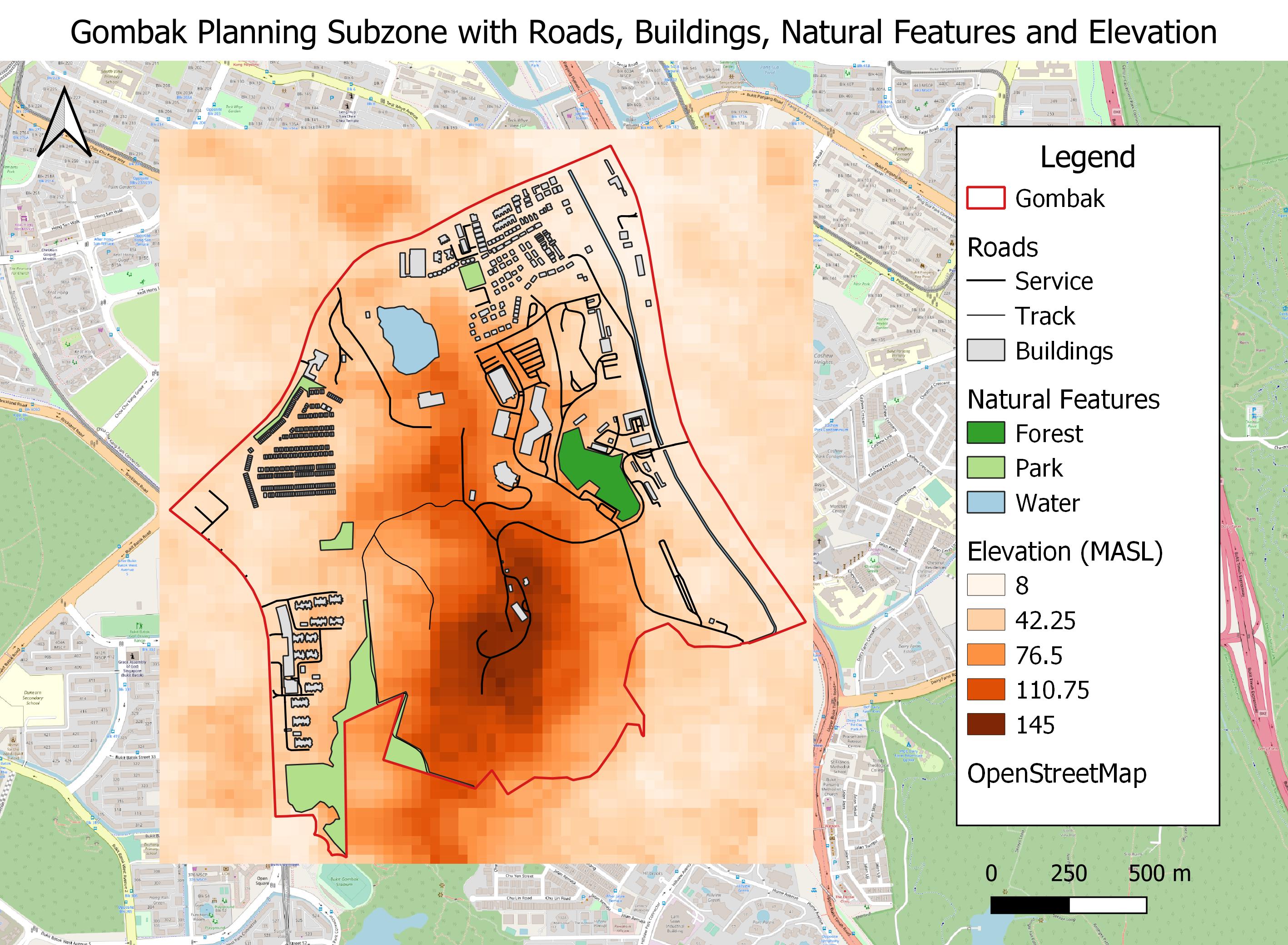
Depicts the points of interests in Gombak Planning Subzone that are important to the site selection of a National Communicable Disease Quarantine Centre.
File history
Click on a date/time to view the file as it appeared at that time.
| Date/Time | Thumbnail | Dimensions | User | Comment | |
|---|---|---|---|---|---|
| current | 23:27, 4 November 2019 | | 2,835 × 2,082 (751 KB) | Yunyu.chong.2018 (talk | contribs) | Edited legend |
| 18:16, 3 November 2019 |  | 2,835 × 2,082 (737 KB) | Yunyu.chong.2018 (talk | contribs) |
- You cannot overwrite this file.
File usage
The following page links to this file: