File:G-chart.jpg
Jump to navigation
Jump to search
Size of this preview: 437 × 599 pixels. Other resolutions: 175 × 240 pixels | 469 × 643 pixels.
Original file (469 × 643 pixels, file size: 76 KB, MIME type: image/jpeg)
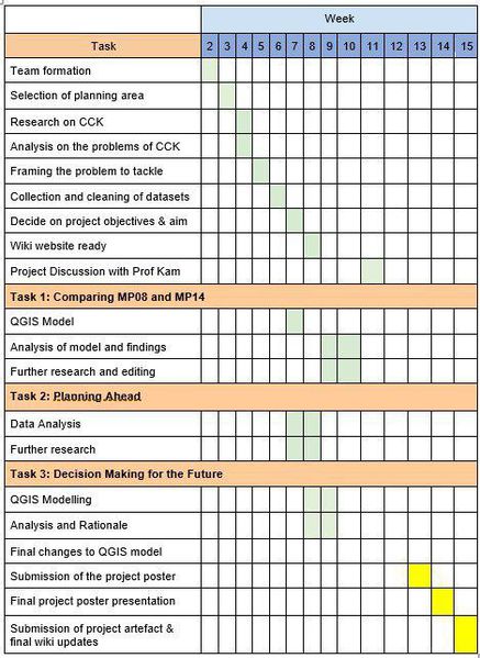
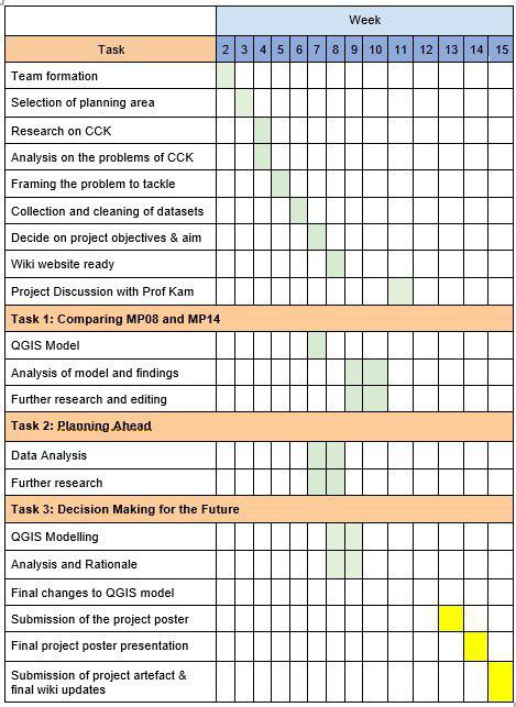
Plan
File history
Click on a date/time to view the file as it appeared at that time.
| Date/Time | Thumbnail | Dimensions | User | Comment | |
|---|---|---|---|---|---|
| current | 17:14, 16 October 2019 | | 469 × 643 (76 KB) | Pohyeng.ng.2017 (talk | contribs) |
- You cannot overwrite this file.
File usage
The following 2 pages link to this file: