File:Education.jpg
Jump to navigation
Jump to search

Size of this preview: 800 × 565 pixels. Other resolutions: 320 × 226 pixels | 2,923 × 2,066 pixels.
Original file (2,923 × 2,066 pixels, file size: 1.73 MB, MIME type: image/png)
Summary
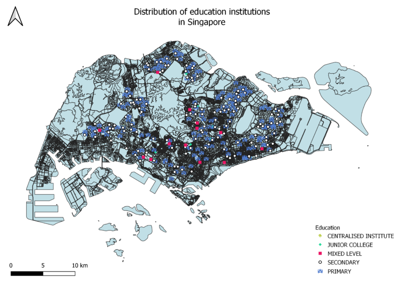
The Education layer and the MP14 Landuse layer can be seen in this image. The different SVG markers represent the different types of educational institutes in Singapore.
File history
Click on a date/time to view the file as it appeared at that time.
| Date/Time | Thumbnail | Dimensions | User | Comment | |
|---|---|---|---|---|---|
| current | 16:07, 15 September 2019 | | 2,923 × 2,066 (1.73 MB) | Vanessa.au.2018 (talk | contribs) | The Education layer and the MP14 Landuse layer can be seen in this image. The different SVG markers represent the different types of educational institutes in Singapore. |
- You cannot overwrite this file.
File usage
The following file is a duplicate of this file (more details):
There are no pages that use this file.