File:Calculating Land Lot Suitability (Out of 100).jpg
Jump to navigation
Jump to search
Size of this preview: 669 × 600 pixels. Other resolutions: 268 × 240 pixels | 1,105 × 991 pixels.
Original file (1,105 × 991 pixels, file size: 251 KB, MIME type: image/jpeg)
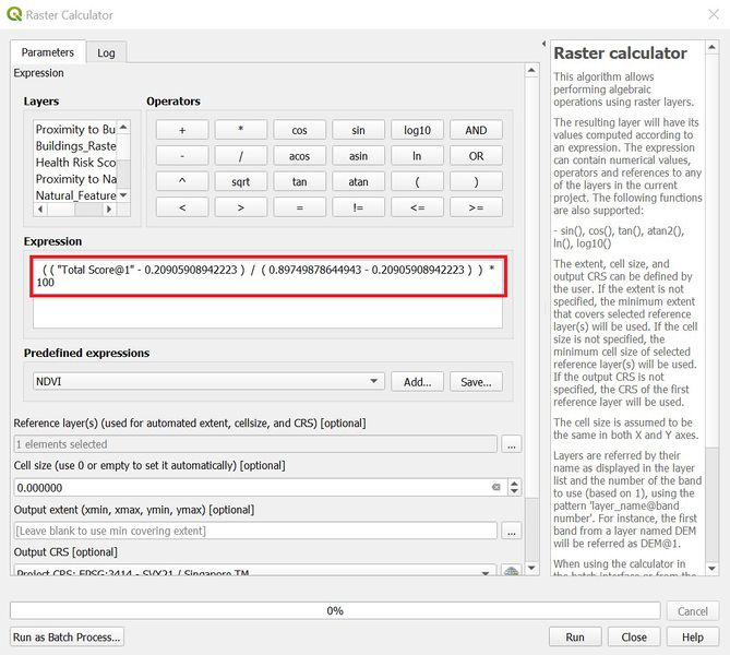
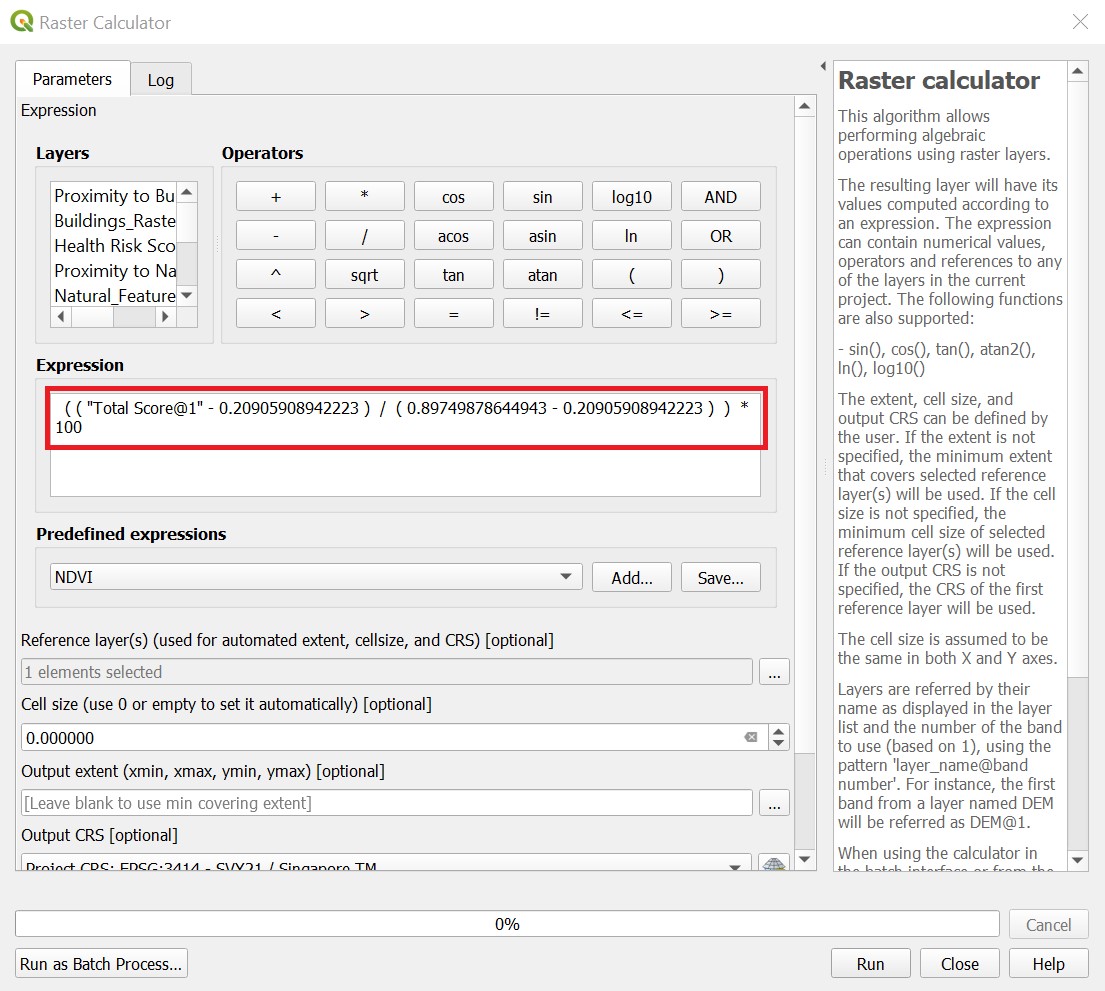
Calculate score out of 100 for easy interpretation
File history
Click on a date/time to view the file as it appeared at that time.
| Date/Time | Thumbnail | Dimensions | User | Comment | |
|---|---|---|---|---|---|
| current | 10:33, 8 November 2019 | | 1,105 × 991 (251 KB) | Yunyu.chong.2018 (talk | contribs) | |
| 14:30, 7 November 2019 |  | 1,105 × 991 (235 KB) | Yunyu.chong.2018 (talk | contribs) |
- You cannot overwrite this file.
File usage
The following page links to this file:
.jpg&oldid=7260)
.jpg)
.jpg&action=edit&redlink=1)
.jpg&action=edit)
.jpg&action=history)
.jpg)
.jpg)
.jpg&printable=yes)
.jpg&oldid=7260)
.jpg&action=info)