File:10population.jpg
Jump to navigation
Jump to search
Size of this preview: 800 × 555 pixels. Other resolutions: 320 × 222 pixels | 948 × 658 pixels.
Original file (948 × 658 pixels, file size: 55 KB, MIME type: image/jpeg)
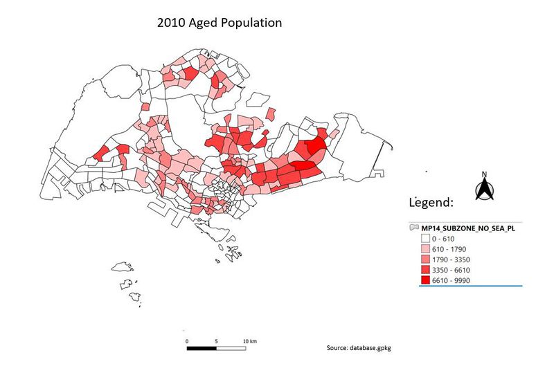
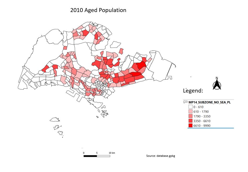
this map shows the geographical distribution of the ageing population in 2010.
File history
Click on a date/time to view the file as it appeared at that time.
| Date/Time | Thumbnail | Dimensions | User | Comment | |
|---|---|---|---|---|---|
| current | 23:30, 15 September 2019 | | 948 × 658 (55 KB) | Pohyeng.ng.2017 (talk | contribs) |
- You cannot overwrite this file.
File usage
The following page links to this file: