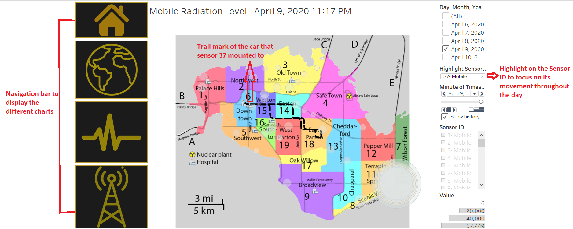
File:Mobilemapchartradiationlevel.PNG
Revision as of 16:32, 3 October 2019 by Tjohnson.2016 (talk | contribs)
Size of this preview: 800 × 321 pixels. Other resolutions: 320 × 128 pixels | 1,875 × 752 pixels.
Original file (1,875 × 752 pixels, file size: 377 KB, MIME type: image/png)
File history
Click on a date/time to view the file as it appeared at that time.
| Date/Time | Thumbnail | Dimensions | User | Comment | |
|---|---|---|---|---|---|
| current | 15:54, 10 October 2019 | 1,875 × 752 (377 KB) | Tjohnson.2016 (talk | contribs) | ||
| 14:22, 5 October 2019 |  | 1,368 × 692 (250 KB) | Tjohnson.2016 (talk | contribs) | ||
| 16:32, 3 October 2019 |  | 955 × 507 (192 KB) | Tjohnson.2016 (talk | contribs) |
- You cannot overwrite this file.
File usage
The following page links to this file: