File:StHimarkNeighborhoodMap.png
Revision as of 16:19, 12 October 2019 by Jimmeng.kok.2017 (talk | contribs)

Size of this preview: 725 × 600 pixels. Other resolutions: 290 × 240 pixels | 995 × 823 pixels.
Original file (995 × 823 pixels, file size: 98 KB, MIME type: image/png)
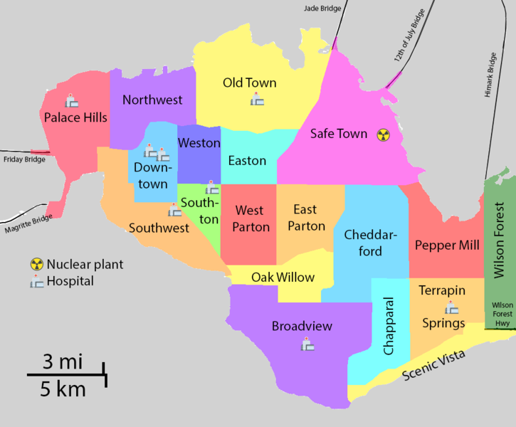
Map of St Himark Neighbourhood
File history
Click on a date/time to view the file as it appeared at that time.
| Date/Time | Thumbnail | Dimensions | User | Comment | |
|---|---|---|---|---|---|
| current | 16:19, 12 October 2019 | | 995 × 823 (98 KB) | Jimmeng.kok.2017 (talk | contribs) |
- You cannot overwrite this file.
File usage
The following 6 pages link to this file:
- IS428 AY2019-20T1 Assign Kok Jim Meng
- IS428 AY2019-20T1 Assign Kok Jim Meng Data Preparation
- IS428 AY2019-20T1 Assign Kok Jim Meng Interactive Visualisation
- IS428 AY2019-20T1 Assign Kok Jim Meng Problem & Motivation
- IS428 AY2019-20T1 Assign Kok Jim Meng References and Comments
- IS428 AY2019-20T1 Assign Kok Jim Meng Tasks Questions and Answers