IS428 AY2019-20T1 Assign Wong Kuan Wai Gordon
Contents
Overview
St. Himark has been hit by an earthquake, leaving officials scrambling to determine the extent of the damage and dispatch limited resources to the areas in most need. They quickly receive seismic readings and use those for an initial deployment but realize they need more information to make sure they have a realistic understanding of the true conditions throughout the city.
In a prescient move of community engagement, the city had released a new damage reporting mobile application shortly before the earthquake. This app allows citizens to provide more timely information to the city to help them understand damage and prioritize their response. In this mini-challenge, use app responses in conjunction with shake maps of the earthquake strength to identify areas of concern and advise emergency planners. Note: the shake maps are from April 6 and April 8 respectively. With emergency services stretched thin, officials are relying on citizens to provide them with much needed information about the effects of the quake to help focus recovery efforts. By combining seismic readings of the quake, responses from the app, and background knowledge of the city, help the city triage their efforts for rescue and recovery.
Objective
My task as a visual analytics expert is to analyze and provide interactive visualizations through seismic readings of the earthquake, damage reports from the mobile application and background knowledge of the city. These visualizations will enable citizens and emergency planners with situational awareness of the disaster. Ultimately, this will further optimize the response of emergency services by enabling them to dispatch their limited resources to the right place at the right time with the right emergency tools, prioritizing their efforts for rescue and recovery. Therefore, my task as a visual analytics expert will explore the following:
1) Geometric damage patterns of St. Himark and its neighborhood
2) Earthquake scale and classes based on seismic readings
3) Sending the correct emergency response based on infrastructure damages
4) Damage inflicted to St. Himark infrastructures in each neighborhood
5) Uncertainty of damage reports
Task #1: Emergency responders will base their initial response on the earthquake shake map. Use visual analytics to determine how their response should change based on damage reports from citizens on the ground. How would you prioritize neighborhoods for response? Which parts of the city are hardest hit?
Task #2: Use visual analytics to show uncertainty in the data. Compare the reliability of neighborhood reports. Which neighborhoods are providing reliable reports? Provide a rationale for your response.
Task #3: How do conditions change over time? How does uncertainty in change over time? Describe the key changes you see.
About the Data
The data for Mini-Challenge 1 includes one (CSV) file spanning the entire length of the event, containing (categorical) individual reports of shaking/damage by neighborhood over time. Reports are made by citizens at any time, however, they are only recorded in 5-minute batches/increments due to the server configuration. The fields of the data and its relevance are as follows:
1) time: timestamp of incoming report/record, in the format YYYY-MM-DD hh:mm:ss
2) sewer_and_water: Value of how bad the damage was to St. Himark's sewer and water infrastructure (0 - lowest, 10 - highest; missing data allowed)
3) power: Value of how bad the damage was to St. Himark's power infrastructure (0 - lowest, 10 - highest; missing data allowed)
4) roads_and_bridges: Value of how bad the damage was to St. Himark's roads and bridges infrastructure (0 - lowest, 10 - highest; missing data allowed)
5) medical: Value of how bad the damage was to St. Himark's medical infrastructure (0 - lowest, 10 - highest; missing data allowed)
6) buildings: Value of how bad the damage was to St. Himark's buildings infrastructure (0 - lowest, 10 - highest; missing data allowed)
7) shake_intensity: Value of how violent the shaking was (0 - lowest, 10 - highest; missing data allowed)
8) location: ID of neighborhood where person reporting is feeling the shaking and/or seeing the damage
The Shapefile "StHimark.shp" and image "StHimarkMapBlank.png" was taken from Mini-Challenge 2 to be used to map and display the St. Himark map
Data Preparation
Tools Used:
Data Preparation for St. Himark Map
The aim for this step is to be able to display the background overlay "StHimarkBlankMap.png" along with the given the Shapefile "StHimark.shp" from Mini-Challenge 2.
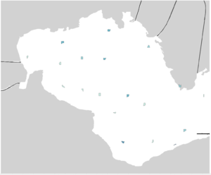
However, performing these steps alone produced the following undesired results:
With reference to Kelvin Chia and research in the Tableau community, this undesired result was produced as Tableau is unable to identify and determine how the polygons are scaled by the Geometry which then defaults the polygons to be small in size and placed as centroids.
The Visualization
Testing
Tasks
Testing
References
Testing
Comments
Feel free to provide feedback!


