File:Map 4.2 Local Moran's I for Residential REEI.png
Revision as of 10:33, 19 March 2019 by Darren.choy.2017 (talk | contribs)
Size of this preview: 463 × 599 pixels. Other resolutions: 185 × 240 pixels | 816 × 1,056 pixels.
Original file (816 × 1,056 pixels, file size: 279 KB, MIME type: image/png)
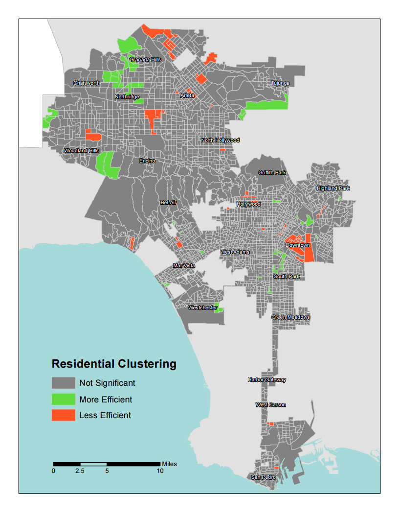
Map 4.2 Local Moran's I for Residential REEI
File history
Click on a date/time to view the file as it appeared at that time.
| Date/Time | Thumbnail | Dimensions | User | Comment | |
|---|---|---|---|---|---|
| current | 10:33, 19 March 2019 | | 816 × 1,056 (279 KB) | Darren.choy.2017 (talk | contribs) |
- You cannot overwrite this file.
File usage
The following page links to this file: