BusinessMafia Proposal
Revision as of 22:31, 18 March 2019 by Jiakhee.lim.2015 (talk | contribs)
Contents
Project Motivation
Airbnb has been democratic in providing its data access to the public for potential analysis. However, there is a lack of an aggregated platform to distill this mass of data into information that allow Airbnb hosts better understand the demands of the travelers coming into their city. Certain Airbnbs possess higher occupancy rates than others, the factors affecting it also differ from city to city and culture to culture. The reasons for visiting and type of travelers attracted also differ; as certain cities may attract more business travelers seeking comfort, while others attract backpackers looking for an affordable bed and breakfast accommodation.
With this in mind, our team is delving into the landscape of Seattle, Washington in United States to identity relationships and spatial patterns affecting the occupancy rate of Airbnbs in Seattle. We aim to help hosts better understand the demands of the travelers coming into their city, and how they can therefore increase their occupancy rates.
Project Objective
Through our project, we aim to:
- Derive individual walking distance between various key attractions and Airbnb listings in Downtown Seattle
- Analyse the spatial relationships between various key locations and Airbnb listings in Downtown Seattle to determine if the listing's location to key places affect its listing price
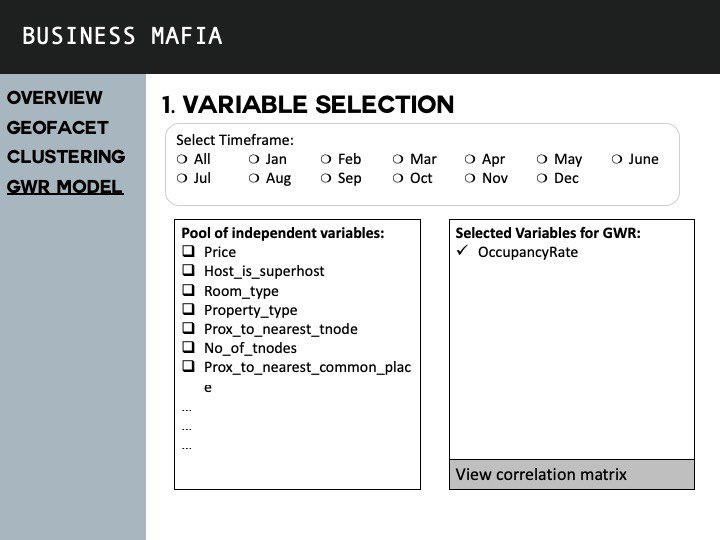
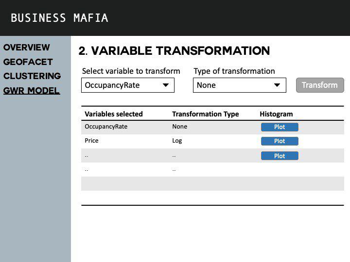
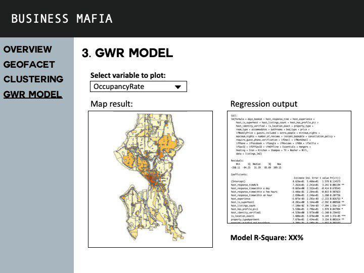
- Through the use of Local Geographical Weighted Regression (GWR) Model, we hope to help Airbnb owner(s) determine the better pricing for their listing(s).
Our Datasets
| Data | Source | Data Description | Source URL | Data Type |
|---|---|---|---|---|
Project Timeline
Literature Review
Our Approach
Project Storyboard


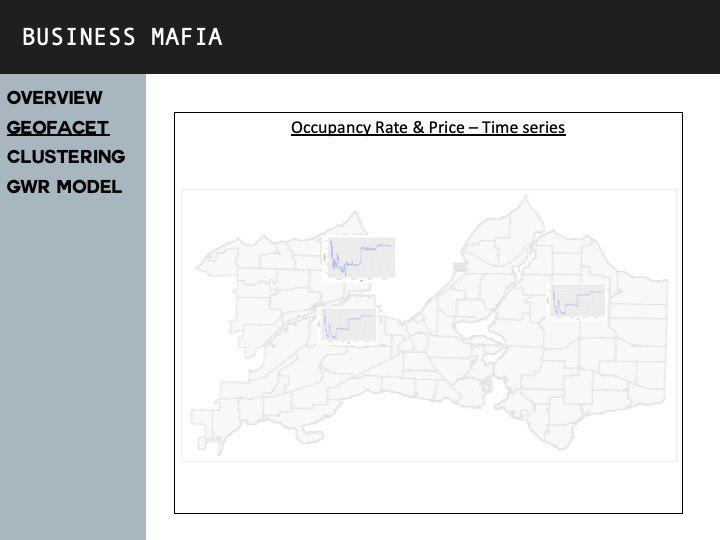
Application Overview