WhereYouGeo Proposal
As more Singaporeans are opting to take public transport for day to day trips, being able to understand the trip patterns of Singaporeans can help to identify interesting insights and these patterns can be used to help improve the environment of Singapore example: building more elderly friendly facilities, more buses services when school is over, etc.
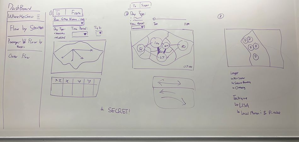
Our project aims to provide an application that will help various government sectors like HDB, URA, SLA and LTA to enable better planning and decision making where it will eventually impact Singaporeans in the future.
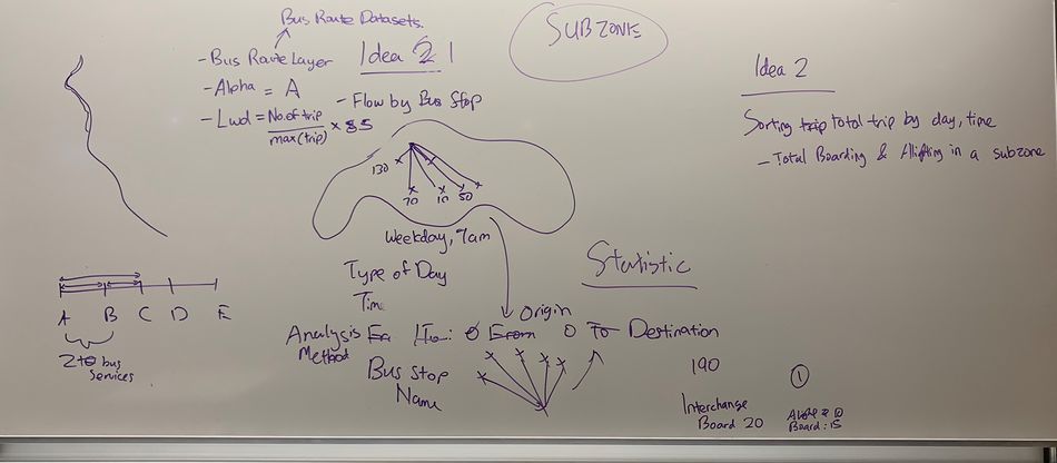
To build an application that does flow analysis using the data generated by trips made. The team also hopes to include more analytics features to bring more use cases for this application.
|
Data Set |
Format |
Data Attributes |
Link |
|
LTA Concession Data |
CSV |
Retrieving in Progress... |
Data from LTA |
|
Bus Stops |
SHP |
|
|
|
Passenger Volume by Bus Stops (Alternative Dataset) |
CSV |
|
LTA DataMall Dynamic Datasets |
|
Passenger Volume by Origin Destination Bus Stops (Alternative Dataset) |
CSV |
|
LTA DataMall Dynamic Datasets |
|
Train Stations |
SHP |
|
|
|
Passenger Volume by Origin Destination Train Stations (Alternative Dataset) |
CSV |
|
LTA DataMall Dynamic Datasets |
|
Passenger Volume by Train Stations (Alternative Dataset) |
CSV |
|
LTA DataMall Dynamic Datasets |
As API Key is required and constraint in time per each request of data (5 mins), our team is unable to provide the link for datasets from "LTA DataMall Dynamic Datasets".
|
No. |
Key Technical Challenges |
Description |
Proposed Solution |
Outcome |
|
1. |
Not familiar with spatial analysis method and its related R packages |
As the team is new to geospatial, there are certain concept that the team is not knowledgeable in. |
Do more self-learning via online research or datacamp |
Fill me in |
|
2. |
Lack of data for analysis |
As Singapore does not collect much data on human traffic flow, this might be a potential challenge for the team to conduct spatial analysis. |
Look for relevant agencies or find different data sets to merge and conduct spatial analysis. |
Fill me in |
|
No. |
Website Name |
Link |
|
1. |
GIS Lounge |
|
|
2. |
YouTube (This project is part of "Open Data Challenge for Public Transport in Tokyo 2017".) |
Heavy 4D Tokyo |
|
3. |
Anita Graser |
|
No. |
Name |
Date |
Comments |
|
1. |
Insert your Name here |
Insert Date here |
Insert Comment here |
|
2. |
Insert your Name here |
Insert Date here |
Insert Comment here |
|
3. |
Insert your Name here |
Insert Date here |
Insert Comment here |


