Difference between revisions of "Dangy"
| Line 46: | Line 46: | ||
Using the developed tool, the project will also provide an analysis offering an intuition of how dengue fever spread across Taiwan. Through identifying and studying the transmission patterns of dengue over time, this project will help us better understand patterns and discover strategies on how to curb with epidemics in future & steps to prevent Dengue in Taiwan and similar states. | Using the developed tool, the project will also provide an analysis offering an intuition of how dengue fever spread across Taiwan. Through identifying and studying the transmission patterns of dengue over time, this project will help us better understand patterns and discover strategies on how to curb with epidemics in future & steps to prevent Dengue in Taiwan and similar states. | ||
| − | |||
| − | |||
| − | |||
| − | |||
| − | |||
| − | |||
| − | |||
| − | |||
| − | |||
| − | |||
| − | |||
| − | |||
| − | |||
| − | |||
| − | |||
| − | |||
| − | |||
| − | |||
| − | |||
| − | |||
| − | |||
| − | |||
| − | |||
| − | |||
| − | |||
| − | |||
| − | |||
| − | |||
| − | |||
| − | |||
| − | |||
| − | |||
| − | |||
| − | |||
| − | |||
| − | |||
| − | |||
| − | |||
| − | |||
| − | |||
| − | |||
Revision as of 22:34, 14 April 2019
| Group Members |
Ang Kah Eng
Jerry Obadiah Tohvan
Tan Kai Xiang, Terence
| Project Description |
This project will develop an exploratory solution that supports the study of how dengue fever spread. The tool will also offer historical data of various types, like patient demographics, for users to refer to as they study the spatial temporal patterns of how the disease spreads. Through this, the tool will empower users to analyse the disease quickly and offer insight for authorities to take appropriate measure to prevent the breeding of dengue. For our project, we will be build our tool specifically for Taiwan. This is because data for dengue fever in Taiwan is readily available for analysis. Also, considering how Taiwan has a good mix of different settlements and terrains, it is a good region for us to build our application upon.
Using the developed tool, the project will also provide an analysis offering an intuition of how dengue fever spread across Taiwan. Through identifying and studying the transmission patterns of dengue over time, this project will help us better understand patterns and discover strategies on how to curb with epidemics in future & steps to prevent Dengue in Taiwan and similar states.
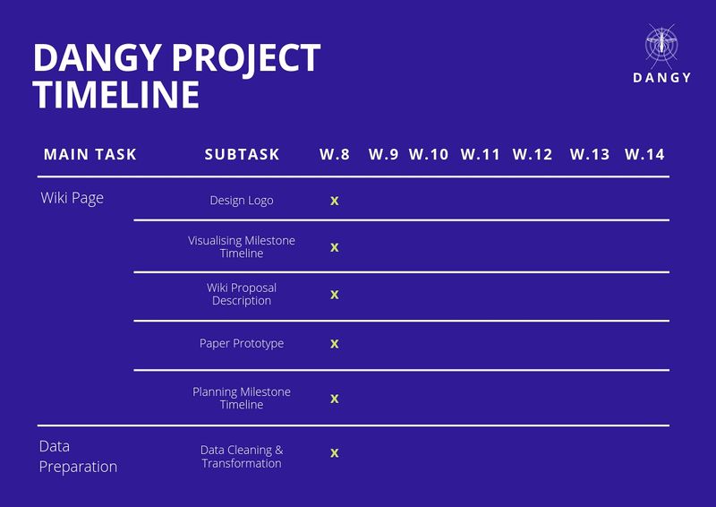
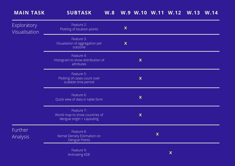
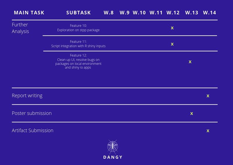
| Project Timeline |


