Difference between revisions of "Sofia City: Data Preparation"
Yqchia.2017 (talk | contribs) |
Yqchia.2017 (talk | contribs) |
||
| Line 31: | Line 31: | ||
<br/> | <br/> | ||
<font size="4">'''Data Preparation'''</font> | <font size="4">'''Data Preparation'''</font> | ||
| + | |||
| + | ==EEA Dataset== | ||
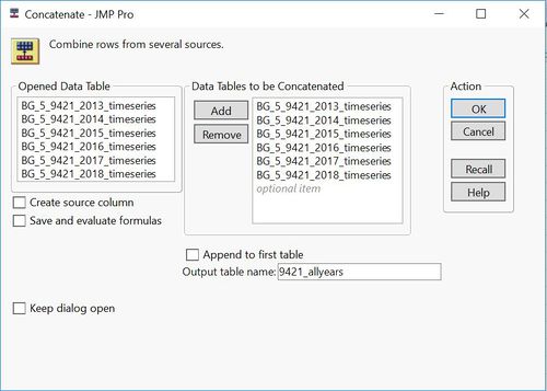
| + | The EEA folder comes with 28 files across 6 stations from 2013-2018. It is observed that some of the stations do not have complete records (denoted by x in table below) across the years notably Orlov Most and Mladost. We first consolidate the dataset for each station by concatenating the files from 2013-2018.<br/> | ||
| + | |||
| + | |||
| + | [[File:Concat 9421.jpg|500px|frameless]] <br/> | ||
| + | |||
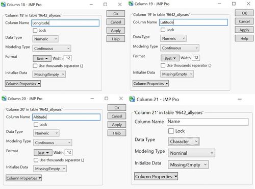
| + | The original files do not come with information on geographical location, altitude as well as common names of the station. These information, however, could be found inside the metadata table provided. We were to add these information into the individual air tube files by creating new columns “Longitude”, “Latitude”, “Altitude” and “Name” respectively.<br/> | ||
| + | [[File:Addincolumns.jpg|500px|frameless|left]] <br/> | ||
| + | |||
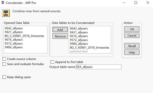
| + | The final working file is created by concatenating dataset from all 6 stations across all years.<br/> | ||
| + | |||
| + | [[File:Combine EEA.jpg|500px|frameless|left]] <br/> | ||
| + | |||
| + | ==Air Tube Dataset== | ||
Revision as of 12:03, 18 November 2018
|
|
|
|
|
|
|
Data Preparation
EEA Dataset
The EEA folder comes with 28 files across 6 stations from 2013-2018. It is observed that some of the stations do not have complete records (denoted by x in table below) across the years notably Orlov Most and Mladost. We first consolidate the dataset for each station by concatenating the files from 2013-2018.
The original files do not come with information on geographical location, altitude as well as common names of the station. These information, however, could be found inside the metadata table provided. We were to add these information into the individual air tube files by creating new columns “Longitude”, “Latitude”, “Altitude” and “Name” respectively.
The final working file is created by concatenating dataset from all 6 stations across all years.


