ISSS608 2016-17 T3 Assign APARAJITA SHUKLA Visualizations
VAST MINI CHALLENGE 2:
Like a Duck to Water
|
|
|
|
Question 1
Characterize the past and most recent situation with respect to chemical contamination in the Boonsong Lekagul waterways. Do you see any trends of possible interest in this investigation?
As the main concern of the professors was to not able to find the presence of methylosmolene in from the soil sample, we will initiate our investigation starting from looking for the presence of hazardous chemical methylosmolene in the water.
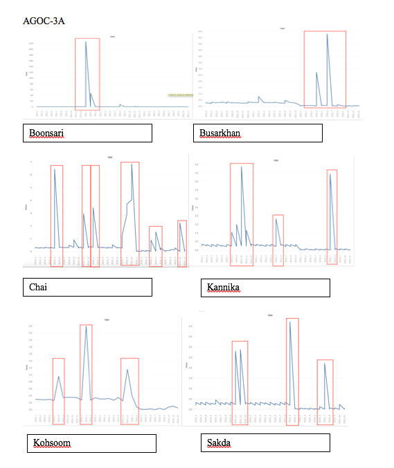
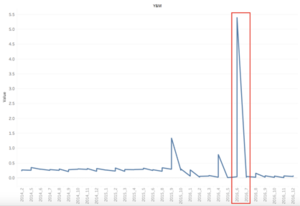
The line charts provided above gives us a macro view of months cross years. All the graphs above shows the concentration of AGOC-3A present in different areas. The spikes marked with red rectangle shows the month where the reading of AGOC-3A was out of ordinary from the usual readings.
Chlorodinine
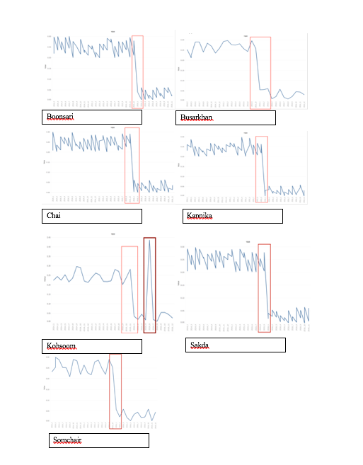
The line charts provided above gives us a macro view of months cross years. All the graphs above shows the concentration of Cholorodinine present in different areas. The spikes marked with red rectangle shows the month where the reading of AGOC-3A was out of ordinary from the usual readings.
Also, we can see all the graphs above follow a particular trend except the graph of Kohsoom.
Methylosmolene
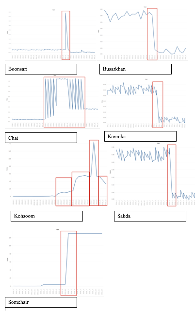
The line charts provided above gives us a macro view of months cross years. All the graphs above shows the concentration of Methylosmolene present in different areas. The spikes marked with red rectangle shows the month where the reading of AGOC-3A was out of ordinary from the usual readings. Busarkkhan , Kannika and Sakda show a similar pattern to Chlorodinine whereas Somchai shows a constant level of contamination starting from 2015 October till date.
Methylosmolene
2014-Reading
From the data set provided, it has been noticed that the presence of Methylosmolene first
Seen in the year 2014, where Kannika marked above was found containing the maximum amount of Methylosmolene i.e. 0.371 ug/l.
However three places namely Achara, Tansanee and Decha did not have any record to testify if methylosmolene was present in the water around them or not.
2015-Reading
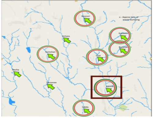
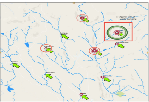
In year 2015 we can see that the presence of methlyosmolene at Kohsoom has topped the list of having the most amount of presence of methlyosmolene in water, increased to 6.4 ug/l from 0.345 ug/l (2014), If seen properly, one can notice that Kohsoom is quite close to the dumping area marked in the map. This increase is also seen in other areas like Somchair.
Checking Missing Values
To check the missing values, I have used JMP.
As can be seen from the image above, there were no missing value present in given dataset.
Getting the Map
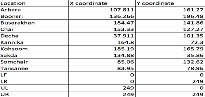
After importing data file into tableau, we first import the image of the map and using annotate using points, I marked all the locations in the map and manually created a separate .xslx file:
And then create map by dragging and dropping the coordinates on the worksheet.
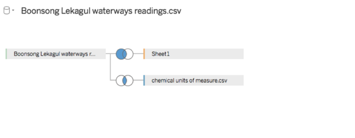
Joining the Tables
As we needed to join Location table, measure.csv and Boonsong Lekagul waterways readings.csv tables together, the tool used for this is Tableau:
