File:Maptimization poster.jpg
Jump to navigation
Jump to search
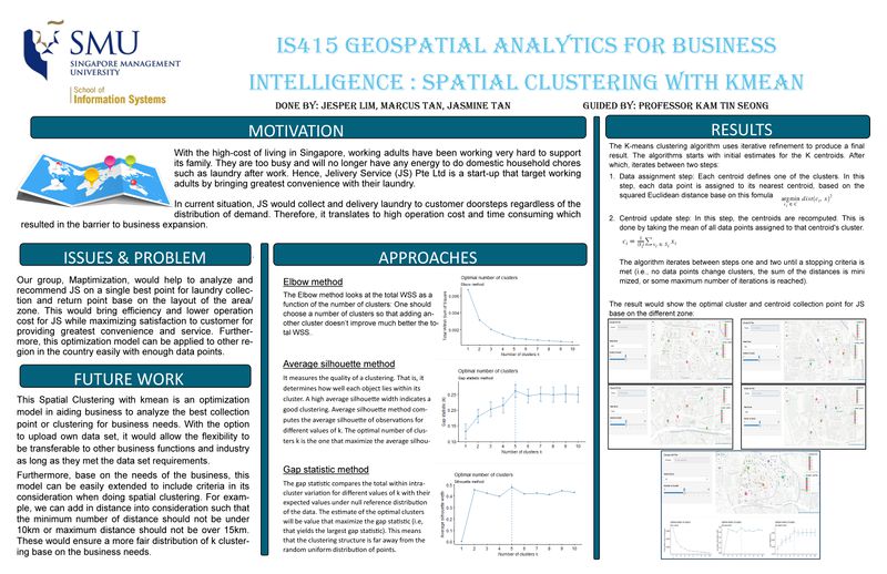

Size of this preview: 800 × 518 pixels. Other resolutions: 320 × 207 pixels | 10,205 × 6,602 pixels.
Original file (10,205 × 6,602 pixels, file size: 6.83 MB, MIME type: image/jpeg)
File history
Click on a date/time to view the file as it appeared at that time.
| Date/Time | Thumbnail | Dimensions | User | Comment | |
|---|---|---|---|---|---|
| current | 12:57, 10 April 2018 | | 10,205 × 6,602 (6.83 MB) | Jasmine.tan.2014 (talk | contribs) | |
| 21:55, 8 April 2018 |  | 10,205 × 6,603 (4.78 MB) | Jasmine.tan.2014 (talk | contribs) |
- You cannot overwrite this file.
File usage
There are no pages that use this file.