ParcFinder Proposal
Contents
Project Background
Issues and Problems
With the expansion of E-Commerce in Singapore, there is a growing demand for the provision of effective logistical services to facilitate the delivery and receiving of goods and services to consumers.
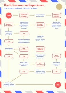
As we analysed the entire customer experience journey in the e-commerce industry, we realised that there is a gap in the service delivery process in the event of a missed delivery. A study by the NUS Logistics Institute - Asia Pacific shows that as of 2017, the delivery failure rates in Singapore hover at more than 15%.
Traditionally, customers who missed a delivery from their logistics providers are redirected either to the post office to collect their parcels. They could also be required to make a call to their logistics providers and rescheduling for a redelivery, and at times required to pay an additional fee for the services. As for the logistics providers, carrying out redeliveries incurs additional operational costs in terms of man-hours and resources.
Motivation
Project Aim
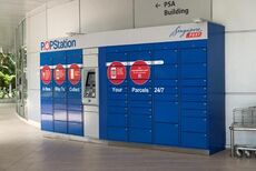
Our team has explored the Self-Collection Points as a viable solution in addressing the issue of missed deliveries. We recognise the importance for Logistic Companies to be able to determine the location of their self-collection points, in order to maximise coverage as well as improving their last-mile delivery service experience for their customers.
Proposed Solution
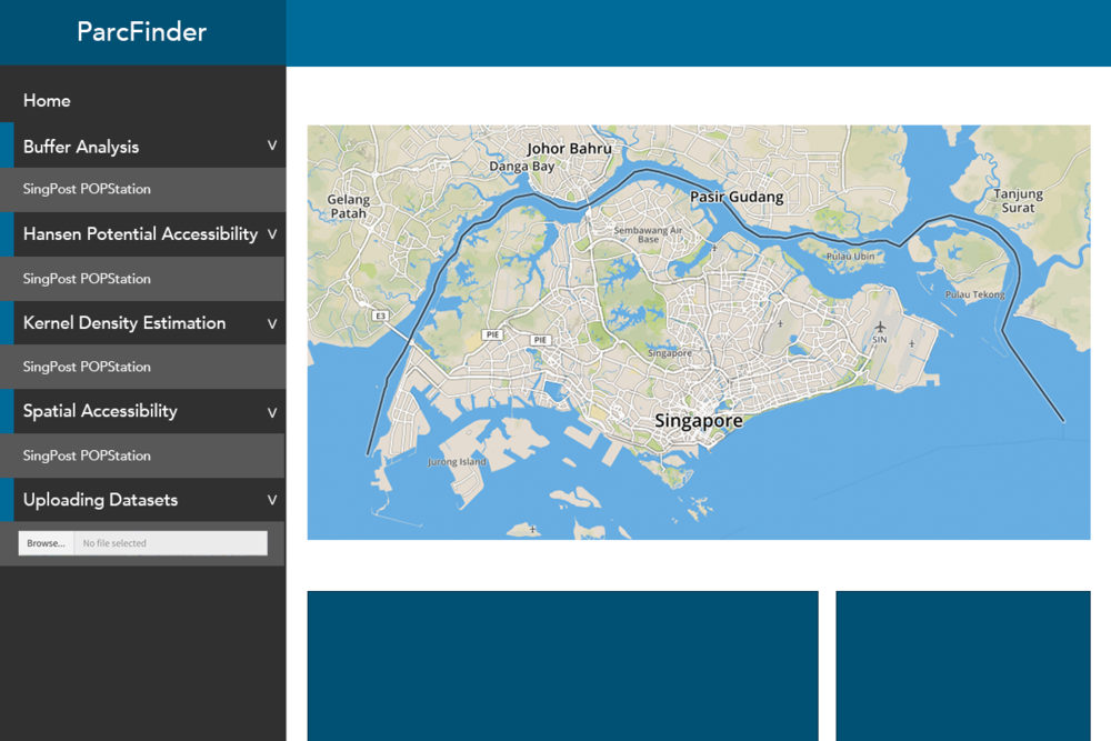
Through the conceptualisation of our application - ParcFinder, we provide users with the tools to visualise the geographical accessibility and generate spatial analysis reports of their existing self-collection points. We hope to provide the necessary insights for our users in their decision-making process in the location of their self-collection points.
Our project will provide an application that will present to users the following insights and analyses:
Approach - GIS and Accessibility Models Used
ParcFinder is an application that uses various GIS and Accessibility Models and give the user different levels of understanding the geographical accessibility of the self-collection points. These models are as follows, based on the level of analysis and insights each method brings:
Level 1: Catchment Area Buffer Analysis
Level 2: Hansen Potential Accessibility Model
Level 3: Kernel Density Estimation
Level 4: Two-Step Floating Catchment Area Method (For Future Works)
Data Source
|
S/N |
Title |
Format |
Website Link / Sources |
|
1 |
Master Plan 2014 Planning Area |
SHP |
https://data.gov.sg/dataset/master-plan-2014-planning-area-boundary-web |
|
2 |
SingPost Post Office |
Unformatted |
|
|
3 |
SingPost POPStation |
Unformatted |
|
|
4 |
EzBuy |
Unformatted |
|
|
6 |
Residential Location |
csv |
Public Housing: https://www.ema.gov.sg/statistic.aspx?sta_sid=20150617kEhn53Jk6sDQ |
Project Proposal
Project Milestones
Project Storyboard
Project Task Allocation
Case Study
Case Study 1: Singapore Post POPStation
Case Study 2: EzBuy, bluPort and NinjaCollect
ParcFinder Application
Application Architecture
Application Overview
Application Guide
Results and Findings
Challenges and Limitations
Data Cleaning and Transformation
- Data retrieved not available in KML/SHP/XML format
- Team effort to convert to SHP format
- Documentation to keep track of changes.
- Data (longitude and latitude) not provided
- Write script to transform postal codes
- For postal codes that wasn't able to transform using the script, manually retrieve longitude and latitude from Google Map
Future Work
Meet the ParcFinder Team
|
|
|
|
Comments
Please insert your comments here:
|
No. |
Name |
Date |
Comments |
|
1. |
Insert your Name here |
Insert Date here |
Insert Comment here |
|
2. |
Insert your Name here |
Insert Date here |
Insert Comment here |
|
3. |
Insert your Name here |
Insert Date here |
Insert Comment here |
