Difference between revisions of "IS4151718t2Group9: Proposal"
Kyfan.2015 (talk | contribs) |
Kyfan.2015 (talk | contribs) |
||
| Line 70: | Line 70: | ||
<!-- END OF RELATED WORKS---> | <!-- END OF RELATED WORKS---> | ||
| − | <div style="background: #e58824; padding: 20px; line-height: 0.3em; text-indent: 16px;letter-spacing:0.1em;font-size:26px"><font color=#fbfcfd face="Bebas Neue">CHALLENGES</font></div> | + | <div style="background: #e58824; padding: 20px; line-height: 0.3em; text-indent: 16px;letter-spacing:0.1em;font-size:26px"><font color=#fbfcfd face="Bebas Neue">KEY CHALLENGES</font></div> |
<div style="margin:0px; padding: 10px; background: #f2f4f4; font-family: Open Sans, Arial, sans-serif; border-radius: 7px; text-align:left"> | <div style="margin:0px; padding: 10px; background: #f2f4f4; font-family: Open Sans, Arial, sans-serif; border-radius: 7px; text-align:left"> | ||
<b>Inexperienced with QGIS</b><br> | <b>Inexperienced with QGIS</b><br> | ||
| Line 98: | Line 98: | ||
<br> | <br> | ||
</div> | </div> | ||
| + | |||
| + | <!-- END OF TOOLS AND TECHNOLOGIES---> | ||
| + | |||
| + | |||
| + | <div style="background: #e58824; padding: 20px; line-height: 0.3em; text-indent: 16px;letter-spacing:0.1em;font-size:26px"><font color=#fbfcfd face="Bebas Neue">REFERENCES</font></div> | ||
| + | <div style="margin:0px; padding: 10px; background: #f2f4f4; font-family: Open Sans, Arial, sans-serif; border-radius: 7px; text-align:left"> | ||
| + | <b>To be updated</b><br> | ||
| + | </div> | ||
| + | |||
| + | <!-- END OF REFERENCES---> | ||
| + | |||
| + | <div style="background: #e58824; padding: 20px; line-height: 0.3em; text-indent: 16px;letter-spacing:0.1em;font-size:26px"><font color=#fbfcfd face="Bebas Neue">REFERENCES</font></div> | ||
| + | <div style="margin:0px; padding: 10px; background: #f2f4f4; font-family: Open Sans, Arial, sans-serif; border-radius: 7px; text-align:left"> | ||
| + | <b>We appreciate and cherish all comments. If you have any suggestion on how to improve our project. Please help us by keying in your name and comment. Don't worry, we want to know your name so that we can thank you and ask for more details. And we don't bite. (: </b><br> | ||
| + | </div> | ||
| + | {| class="wikitable" style="background-color:#FFFFFF;" width="100%" | ||
| + | |- | ||
| + | | | ||
| + | <b>No. | ||
| + | || | ||
| + | Name | ||
| + | || | ||
| + | Date | ||
| + | || | ||
| + | Comments</b> | ||
| + | |- | ||
| + | | | ||
| + | 1. | ||
| + | || | ||
| + | Insert your Name here | ||
| + | || | ||
| + | Insert Date here | ||
| + | || | ||
| + | Insert Comment here | ||
| + | |- | ||
| + | | | ||
| + | 2. | ||
| + | || | ||
| + | Insert your Name here | ||
| + | || | ||
| + | Insert Date here | ||
| + | || | ||
| + | Insert Comment here | ||
| + | |- | ||
| + | |} | ||
| + | |||
| + | |||
| + | <!-- END OF REFERENCES---> | ||
<!-- End Body ---> | <!-- End Body ---> | ||
Revision as of 20:56, 28 January 2018
|
Risk and hazard are terms commonly used to describe aspects of the potential for harm caused by environmental factors and other agents. Since 2014, Singapore has been striving to achieve the vision of being a smart nation. The most integral step in this direction is the analysis and assessment of risk, for it is only by doing so that we can build a healthy, safe and prepared smart nation. After all the steps taken by the Singaporean government and society to be more risk-free, it is important to understand our vulnerability - in terms of dominant contributing factors, location and key institutions that could potentially be affected by these risks. "Risk" is an umbrella term that could cover a number of topics and factors. It could even span industries. Therefore for the purpose of this study, we will define the boundaries of our risk assessment according to 4 agents of risk namely, 1. Biological(biohazards), |
1. Identify and highlight the institutions that conduct activities that pose risks to society
2. Analyse and evaluate the risks associated with that risk or hazard
3. Analyse and evaluate thereafter, the risks associated with specific regions and locations in Singapore
For now, our team's datasets are retrieved from https://data.gov.sg
Our team is still searching online for more available datasets
Will be uploading soon
Inexperienced with QGIS
- Self learning through youtube and practices.
- Ask Prof Kam for help
- Peer to peer learning
Lack of Data
- Google is our best friend
- Ask around (peers) for website advices
Data cleaning and transformation
- Team effort
- Documentation to keep track of changes.
Misunderstanding and Misinterreptation of Project
- Constant meeting with Prof Kam
- Constant team meeting (every monday 12pm-1pm).
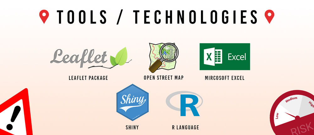
The following are tools and technologies that our team currently believes that we will be using (to be updated)
To be updated
We appreciate and cherish all comments. If you have any suggestion on how to improve our project. Please help us by keying in your name and comment. Don't worry, we want to know your name so that we can thank you and ask for more details. And we don't bite. (:
|
No. |
Name |
Date |
Comments |
|
1. |
Insert your Name here |
Insert Date here |
Insert Comment here |
|
2. |
Insert your Name here |
Insert Date here |
Insert Comment here |

