ISSS608 2017-18 T1 Assign GE BIN
Contents
Smartpolis Epidemic Spread
Overview
Smartpolis is a major metropolitan area with a population of approximately two million residents. During the last few days, health professionals at local hospitals have noticed a dramatic increase in reported illnesses.
Observed symptoms are largely flulike and include fever, chills,sweats, aches and pains, fatigue, coughing, breathing difficulty, nausea and vomiting, diarrhea, and enlarged lymph nodes. More recently, there have been several deaths believed to be associated with the current outbreak. City officials fear a possible epidemic and are mobilizing emergency management resources to mitigate the impact. You have been charged with providing an assessment of the situation.
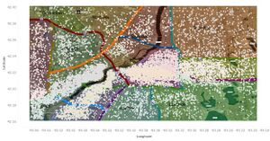
two datasets were provided. The first one contains microblog messages collected from various devices with GPS capabilities. These devices include laptop computers, handheld computers, and cellular phones. The second one contains map information for the entire metropolitan area. The map dataset contains a satellite image with labeled highways, hospitals, important landmarks, and water bodies. We also provide supplemental tables for population statistics and observed weather data.
Task
- Origin and Epidemic Spread
Identify approximately where the outbreak started on the map (ground zero location). Outline the affected area. Explain how you arrived at your conclusion.
- Epidemic Spread
Present a hypothesis on how the infection is being transmitted. For example, is the method of transmission person-to-person, airborne, waterborne, or something else? Identify the trends that support your hypothesis.
Is the outbreak contained? Is it necessary for emergency management personnel to deploy treatment resources outside the affected area? Explain your reasoning.
Work Around
To find the origin and epidemic spread location, airborne and waterborne disease symptoms are filtered via JMP.
| Airborne | Waterborne |
|---|---|
| fever | pain |
| flu | diarrhea |
| headache | nausea |
| sweat | vomit |
| pneumonia | cramp |
| sore throat | loss of appetite |
| caught a fever | aching muscle |
| running nose | reflux |
| problems breathing | heartburn |
| shortness of breath |
Visualisation Software
To perform the visual analysis, students are encouraged to explore any one or a combination of the following software:
- Tableau
- JMP Pro
One of the goals of this assignment is for you to learn to use and evaluate the effectiveness of these visual analytics tools.

